– By Bart Hawkins Kreps and Bumika Srikanthalingam –
The Ontario provincial government is planning a new expressway through primarily rural lands to the north of the existing Toronto urban area. The plan has been opposed by environmental and sustainable city advocates for its expected effects in reducing biodiversity, encouraging urban sprawl, and destroying farmlands, woodlands, and wetlands.
Ecological Footprint analysis offers valuable tools for understanding and picturing the impact of the new highway. This application of Ecological Footprint was the subject of a recent class in the Ecological Footprint Informatics class, offered jointly by York University and the University of Iceland, taught by Eric Miller, Co-Director of IEFLL.
Although the exact route of the highway is still to be finalized, the provincial government provides a provisional map of the 52-kilometre-long highway. In the image below, the Highway 413 is superimposed on a land cover map developed from the Southern Ontario Land Resource Information System. The map is derived from Landsat satellite data with original resolution of pixels 15 metres on each side.
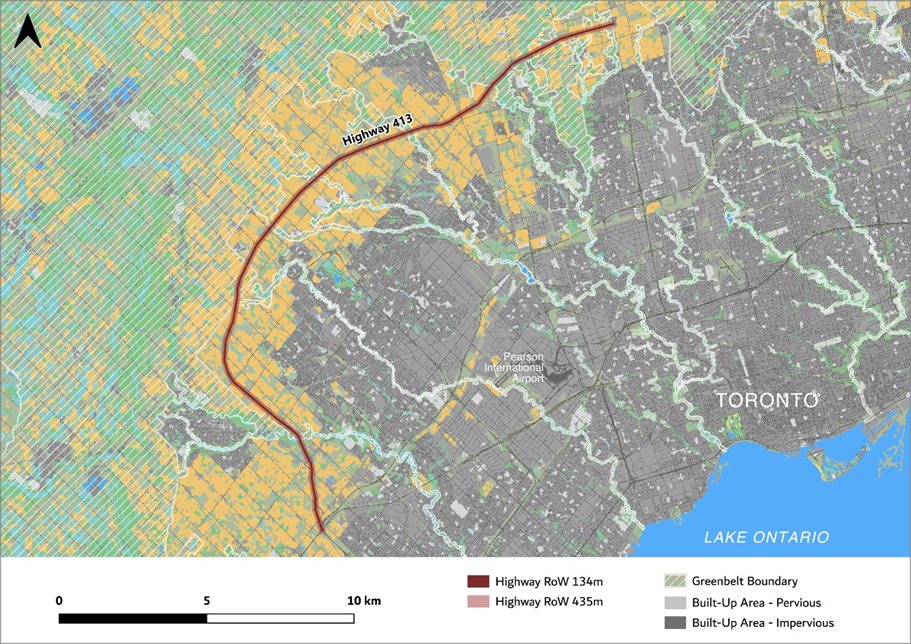
Key features to note are: built-up urban areas are shown in gray and black; farmland is shown in gold; forests and wetlands are shown in green. Ontario’s Greenbelt, which includes farmlands, wetlands, woodlands, as well as river valleys that run through the city, is shown with white cross-hatching. The Greenbelt is legislatively-protected from most types of urban development – though it is not protected from new highway construction.
As shown in the image, the Highway runs through areas of Greenbelt as well as through large areas of farmland outside of the Greenbelt.
The approximately 134 metre-wide right-of-way of the Highway will cover about 692 hectares. About half of this area consists of Class 1 farmland, which is more than four times as productive as the global average for farmland. Applying the weighted Yield Factors to all hectares within the right-of-way, we get 2252 “global hectares” – the standard of measurement used to compare Ecological Footprint of different land types in different regions of the world.
The larger global-hectare-equivalent area of the Highway is more clearly seen in the close-up image below. The 134-metre right-of-way is shown in dark red, with the global hectare equivalent in a lighter red-orange. This provides a graphic representation of the biocapacity that will be sacrificed to the highway.
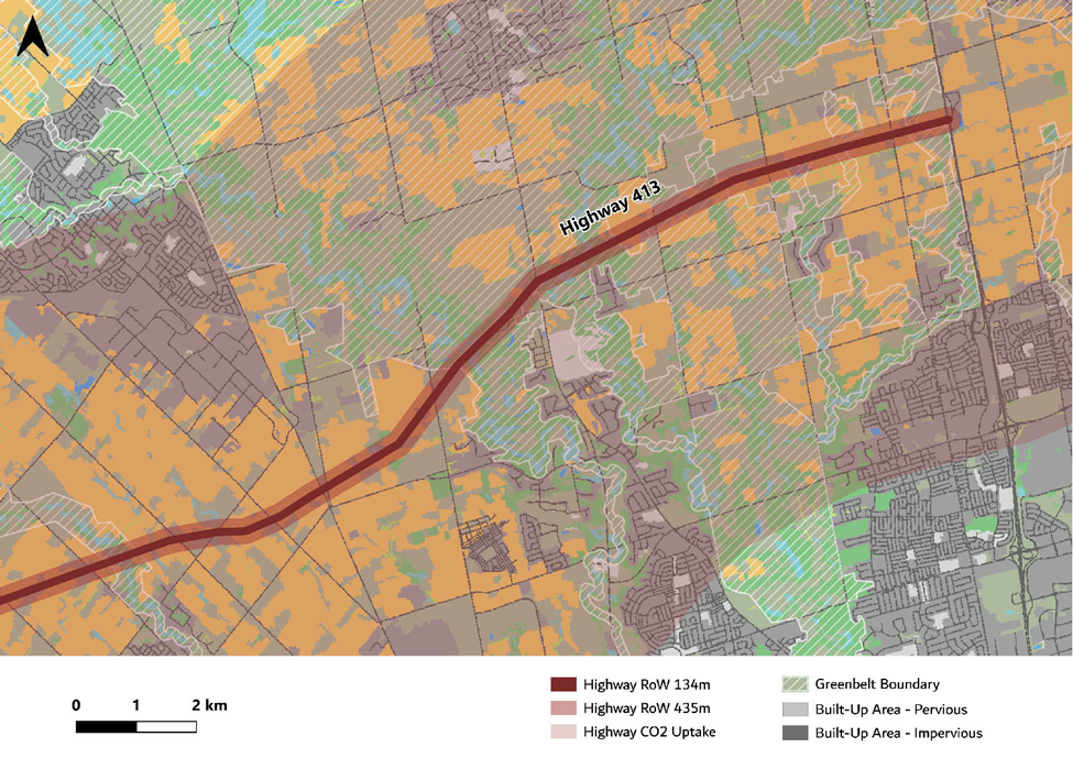
Another important concept of Ecological Footprint analysis is also illustrated in the above image. This is shown with a light orange overlay, taking up most of the image, labelled “Highway CO2 Uptake.”
This area represents an estimation of the forested area that will be needed to absorb the CO2 emitted during the highway’s construction. For this calculation we started with a Statistics Canada estimate of the average carbon emissions for each $1000 spent in the category of “Transportation engineering construction.” Using this emissions co-efficient, and the preliminary cost estimate of $6 billion for the highway’s construction, we calculated it would take almost 1.45 million hectares of Ontario forest land to absorb the construction emissions in one year. For the emissions to be absorbed by forests over 20 years, the land area would be a bit more than 57,000 hectares.
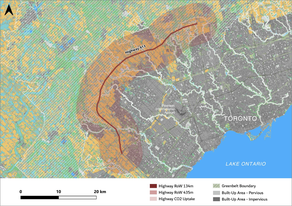
As a consistent-width area along the 52-km length of the highway, this 20-year carbon-uptake equivalent area is 11 km wide, as illustrated below.
This graphic does not attempt to represent the full environmental impact of the proposed expressway. A major highway in this location will impact threatened species, the water quality of downstream water bodies and wetlands, and the potential for downstream flooding during intense rain events. Furthermore, the presence of the highway will be an incentive to additional urban sprawl, thus sacrificing more Class 1 farmland.
Our work here simply illustrates the Ecological Footprint concepts that can be stated in terms of the area of land used. In particular, it shows the outsize role of carbon emission uptake in the land requirements of our current industrial system.
The need for vast areas of forest to absorb our carbon emissions is the largest single reason our global Ecological Footprint is far larger than the Biocapacity of our planet. As shown by this example of Highway 413, the construction of a concrete expressway impacts areas of land many times as large as the highway’s right of way.